Posts: 42988 From: Houston, TX Registered: Nov 1999
posted 02-07-2015 01:19 PM
NOAA release
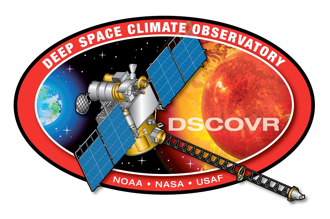
Deep Space Climate Observatory (DSCOVR)
The Deep Space Climate Observatory, or DSCOVR, will maintain the nation's real-time solar wind monitoring capabilities, which are critical to the accuracy and lead time of NOAA's space weather alerts and forecasts.
Without timely and accurate warnings, space weather events like the geomagnetic storms caused by changes in solar wind have the potential to disrupt nearly every major public infrastructure system, including power grids, telecommunications, aviation and GPS.
DSCOVR will succeed NASA's Advanced Composition Explore's (ACE) role in supporting solar wind alerts and warnings from the L1 [Lagrange Point 1] orbit, the neutral gravity point between the Earth and sun approximately one million miles from Earth. L1 is a good position from which to monitor the sun, because the constant stream of particles from the sun (the solar wind) reaches L1 about an hour before reaching Earth.
From this position, DSCOVR will typically be able to provide 15 to 60 minute warning time before the surge of particles and magnetic field, known as a coronal mass ejection (or CME), associated with a geomagnetic storm reaches Earth.
DSCOVR data will also be used to improve predictions of geomagnetic storm impact locations. Our national security and economic well-being, which depend on advanced technologies, are at risk without these advanced warnings.
DSCOVR (formerly known as Triana) was originally conceived in the late 1990s as a NASA Earth science mission that would provide a near continuous view of Earth and measure Earth's complete albedo. The mission was canceled and the satellite was put into storage in 2001. NOAA and the USAF had DSCOVR removed from storage and tested in 2008, and the same year the Committee on Space Environmental Sensor Mitigation Options (CSESMO) determined that DSCOVR was the optimal solution for meeting NOAA and USAF space weather requirements.
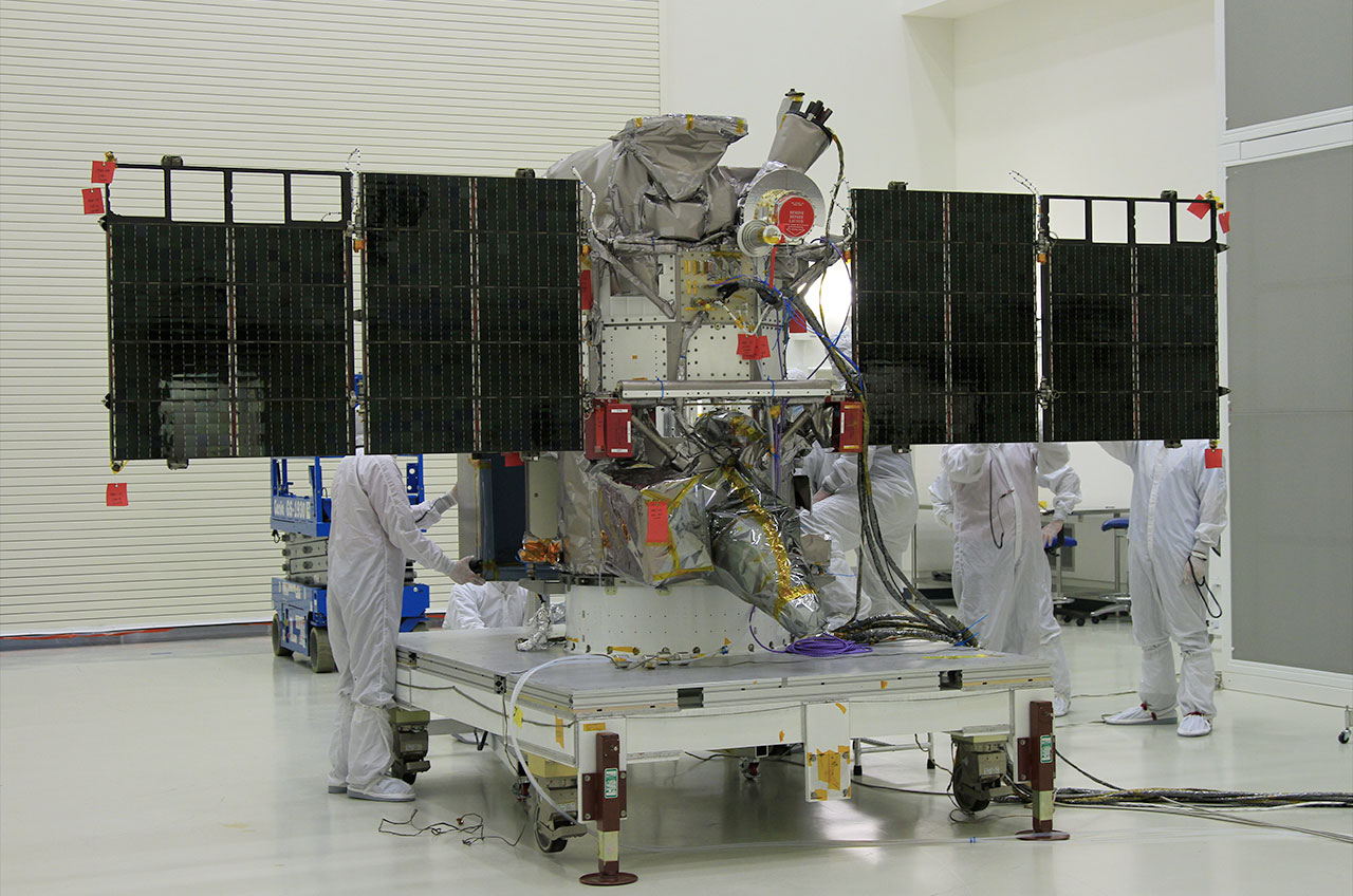
DSCOVR will be approximately 750kg at launch and has dimensions of 54 inches by 72 inches. It will carry the following instruments:
Solar Wind Plasma Sensor (Faraday Cup) and Magnetometer (MAG) (PlasMag): Measures solar wind velocity distribution and the magnitude and direction of the solar wind magnetic field to provide rapid warning of geomagnetic storms.
National Institute of Standards and Technology Advanced Radiometer (NISTAR): Measures whole absolute irradiance integrated over the sunlit face of Earth for climate science applications.
Earth Polychromatic Imaging Camera (EPIC): Provides images of the sunlit side of Earth for science applications such as ozone, aerosols and clouds.
Electron Spectrometer (ES): Provides high temporal resolution (< 1 sec) solar wind observations.
Pulse Height Analyzer (PHA): Provides real-time measurements of particle events that may impact DSCOVR’s electronics.
Robert Pearlman Editor
Posts: 42988 From: Houston, TX Registered: Nov 1999
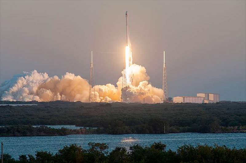
A satellite's mission into deep space has finally gotten off the ground, after getting its start 17 years ago as the brainstorm of a former U.S. vice president.
DSCOVR, or the Deep Space Climate Observatory, is now on a 110-day, almost one million mile journey to Lagrange Point 1, where the gravity between the sun and the Earth is balanced. Once at L1, the refrigerator-sized spacecraft will serve as an early-warning system for solar storms, as well as beam back full-disc sun-lit images of the Earth.
DSCOVR lifted off Wednesday (Feb. 11) at 6:03 p.m. EST (2303 GMT) atop a SpaceX Falcon 9 from Complex 40 at the Cape Canaveral Air Force Station in Florida. Launched under the auspices of the U.S. Air Force, the mission is a joint effort by NASA and NOAA (the National Oceanic and Atmospheric Administration).
Robert Pearlman Editor
Posts: 42988 From: Houston, TX Registered: Nov 1999
posted 06-08-2015 11:17 AM
NOAA release
Nation's first operational satellite in deep space reaches final orbit
Satellite expected to begin operations this summer
More than 100 days after it launched, NOAA's Deep Space Climate Observatory (DSCOVR) satellite has reached its orbit position about one million miles from Earth.
Once final instrument checks are completed, DSCOVR, which will provide improved measurements of solar wind conditions to enhance NOAA's ability to warn of potentially harmful solar activity, will be the nation's first operational space weather satellite in deep space. Its orbit between Earth and the sun is at a location called the Lagrange point 1, or L1, which gives DSCOVR a unique vantage point to see the Earth and sun.
Data from DSCOVR, coupled with a new forecast model set to come online in 2016, will enable NOAA's space weather forecasters to predict geomagnetic storm magnitude on a regional basis. Geomagnetic storms occur when plasma and magnetic fields streaming from the sun impact Earth's magnetic field. Large magnetic eruptions from the sun have the potential to bring major disruptions to power grids, aviation, telecommunications, and GPS systems.
"DSCOVR will trigger early warnings whenever it detects a surge of energy that could cause a geomagnetic storm that could bring possible damaging impacts for Earth," said Stephen Volz, Ph.D., Assistant Administrator for NOAA's Satellite and Information Service.
DSCOVR will eventually replace NASA's Advanced Composition Explorer (ACE) research satellite as America's primary warning system for solar magnetic storms headed towards Earth. ACE will continue to provide valuable research data to the science community.
In addition to space weather-monitoring instruments, DSCOVR is carrying two NASA Earth-observing instruments that will gather a range of measurements from ozone and aerosol amounts, to changes in Earth's radiation budget—the balance between incoming radiation (largely from the sun) and that which is reflected from Earth. This balance affects our climate.
"DSCOVR has reached its final orbit and will soon be ready to begin its mission of space weather monitoring for NOAA and Earth observing for NASA," said Al Vernacchio, DSCOVR project manager at NASA's Goddard Space Flight Center, Greenbelt, Maryland.
NOAA's Space Weather Prediction Center in Boulder, Colo., will begin using data from DSCOVR in its space weather forecasts as soon as DSCOVR is deemed operational.
The DSCOVR mission is a partnership between NOAA, NASA, and the U.S. Air Force. The Air Force provided the Space X Falcon 9 launch vehicle for the mission. NOAA will operate DSCOVR from its NOAA Satellite Operations Facility in Suitland, Maryland, and process the space weather data at NOAA's Space Weather Prediction Center (SWPC) in Boulder, Colorado, one of NOAA's nine National Centers for Environmental Prediction. SWPC will distribute these data to users within the United States and around the world. The data will be archived at NOAA's National Center for Environmental Information.
DSCOVR also hosts NASA-funded secondary sensors for Earth and space science observations. The Earth science data will be processed at NASA's DSCOVR Science Operations Center and archived and distributed by NASA's Atmospheric Science Data Center.
Robert Pearlman Editor
Posts: 42988 From: Houston, TX Registered: Nov 1999
posted 07-20-2015 09:56 AM
NASA release
NASA Captures "EPIC" Earth Image
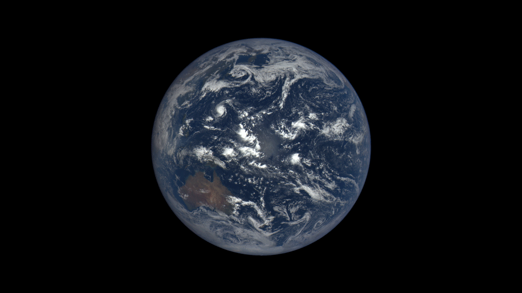
A NASA camera on the Deep Space Climate Observatory satellite has returned its first view of the entire sunlit side of Earth from one million miles away.
This color image of Earth was taken by NASA's Earth Polychromatic Imaging Camera (EPIC), a four megapixel CCD camera and telescope. The image was generated by combining three separate images to create a photographic-quality image. The camera takes a series of 10 images using different narrowband filters -- from ultraviolet to near infrared -- to produce a variety of science products. The red, green and blue channel images are used in these color images.
The image was taken July 6, 2015, showing North and Central America. The central turquoise areas are shallow seas around the Caribbean islands. This Earth image shows the effects of sunlight scattered by air molecules, giving the image a characteristic bluish tint. The EPIC team is working to remove this atmospheric effect from subsequent images. Once the instrument begins regular data acquisition, EPIC will provide a daily series of Earth images allowing for the first time study of daily variations over the entire globe. These images, available 12 to 36 hours after they are acquired, will be posted to a dedicated web page by September 2015.
The primary objective of DSCOVR, a partnership between NASA, the National Oceanic and Atmospheric Administration (NOAA) and the U.S. Air Force, is to maintain the nation's real-time solar wind monitoring capabilities, which are critical to the accuracy and lead time of space weather alerts and forecasts from NOAA.
Robert Pearlman Editor
Posts: 42988 From: Houston, TX Registered: Nov 1999
posted 10-19-2015 11:45 AM
NASA release
Daily views of Earth available on new NASA website
NASA launched a new website Monday so the world can see images of the full, sunlit side of the Earth every day. The images are taken by a NASA camera one million miles away on the Deep Space Climate Observatory (DSCOVR), a partnership between NASA, the National Oceanic and Atmospheric Administration (NOAA) and the U.S. Air Force.
Above: Earth rotates through an entire day as captured in this animation of 22 still images taken on Sept. 17, 2015 by NASA’s Earth Polychromatic Imaging Camera (EPIC) camera on the Deep Space Climate Observatory (DSCOVR) spacecraft.
Once a day NASA will post at least a dozen new color images of Earth acquired from 12 to 36 hours earlier by NASA's Earth Polychromatic Imaging Camera (EPIC). Each daily sequence of images will show the Earth as it rotates, thus revealing the whole globe over the course of a day. The new website also features an archive of EPIC images searchable by date and continent.
The primary objective of NOAA's DSCOVR mission is to maintain the nation's real-time solar wind monitoring capabilities, which are critical to the accuracy and lead time of space weather alerts and forecasts from NOAA. NASA has two Earth-observing instruments on the spacecraft. EPIC's images of Earth allow scientists to study daily variations over the entire globe in such features as vegetation, ozone, aerosols, and cloud height and reflectivity.
EPIC is a four megapixel CCD camera and telescope. The color Earth images are created by combining three separate single-color images to create a photographic-quality image equivalent to a 12-megapixel camera. The camera takes a series of 10 images using different narrowband filters -- from ultraviolet to near infrared -- to produce a variety of science products. The red, green and blue channel images are used to create the color images. Each image is about 3 megabytes in size.
"The effective resolution of the DSCOVR EPIC camera is somewhere between 6.2 and 9.4 miles (10 and 15 kilometers)," said Adam Szabo, DSCOVR project scientist at NASA's Goddard Space Flight Center, Greenbelt, Maryland.
Since Earth is extremely bright in the darkness of space, EPIC has to take very short exposure images (20-100 milliseconds). The much fainter stars are not visible in the background as a result of the short exposure times.
The DSCOVR spacecraft orbits around the L1 Lagrange point directly between Earth and the sun. This orbit keeps the spacecraft near the L1 point and requires only occasional small maneuvers, but its orbit can vary from 4 to 15 degrees away from the sun-Earth line over several years.
EPIC was built by Lockheed Martin's Advanced Technology Center, in Palo Alto, California. Using an 11.8-inch (30-centimeter) telescope and 2048 x 2048 CCD detector, EPIC measures in the ultraviolet, visible and near-infrared areas of the spectrum. The data from all 10 wavelengths are posted through a website hosted by the Atmospheric Science Data Center at NASA's Langley Research Center, Hampton, Virginia. All images are in the public domain.
NASA uses the vantage point of space to increase our understanding of our home planet, improve lives, and safeguard our future. NASA develops new ways to observe and study Earth's interconnected natural systems with long-term data records. The agency freely shares this unique knowledge and works with institutions around the world to gain new insights into how our planet is changing.


 posted 02-07-2015 01:19 PM