|
|

|
|
Author
|
Topic: Ordnance Survey moon landing map
|
minipci
Member Posts: 365
From: London, UK
Registered: Jul 2009
|
 posted 05-16-2019 05:24 AM
  
Ordnance Survey (OS) has released a new map of the Moon to celebrate the 50th anniversary of humans landing there. OS has been producing detailed maps of Great Britain for almost 230 years, but this is the second time the organisation has gone off-planet.It created a map of Mars in 2016 using open data from Nasa. The new Moon map, also using NASA data, was created by cartographer Paul Naylor who wanted to celebrate Neil Armstrong's 1969 moon walk." |
Robert Pearlman
Editor Posts: 42981
From: Houston, TX
Registered: Nov 1999
|
posted 05-16-2019 08:26 AM

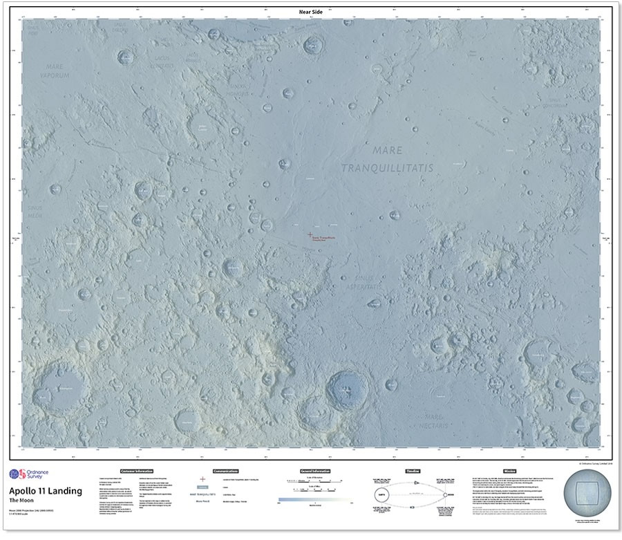
The Map of The Moon: 50th Anniversary Edition Map is available here. A highly-detailed map of the lunar surface shown at 1:1 470 000 scale, centred on the Apollo 11 landing site, created from NASA height data by Ordnance Survey to commemorate the 50th anniversary of the first humans on the moon. Ordnance Survey have created this map of the moon using height data made available by NASA, captured by the Lunar Orbiter Laser Altimeter (LOLA) and the Kagyuga Terrain Camera and shaded to show the heights. The map covers a large section of the near surface of the moon, centred on the Apollo 11 landing site at the edge of Mare Tranquillitatis (Sea of Tranquillity). Larger, named craters are shown, along with the landing site itself - the crater names have been taken from the Gazetteer of Planetary Nomenclature. The area covered is 1350km by 1000km. It's available as both as a rolled poster and a folded map If you are planning a trip to the moon, you will probably be using a digital navigation system (but not GPS). We always recommend bringing a paper map as a backup. - Size: 100 x 89 cm (Folded size: 22.5 x 13 x 1 cm)
- Printed on uncoated map paper
- ISBN 9780319091760
- ISBN 9780319091777
|
cspg
Member Posts: 6210
From: Geneva, Switzerland
Registered: May 2006
|
posted 05-28-2019 07:31 AM
Neat product and indeed shipped in a tube! | |
Contact Us | The Source for Space History & Artifacts
Copyright 2020 collectSPACE.com All rights reserved.

Ultimate Bulletin Board 5.47a
|
|
|
 advertisement advertisement
|