Northrop Grumman's NG-10 mission is scheduled to launch aboard the company's Antares rocket from NASA's Wallops Flight Facility no earlier than November 16. The 5-minute launch window will open at 4:23 a.m. EST/9:23 a.m. UTC.Weather permitting, the launch of Northrop Grumman's Antares rocket from Wallops Island, Virginia on November 16, 2018 will be widely visible along the East Coast.
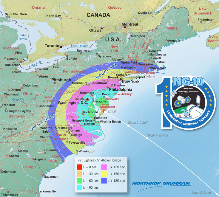
Time of First Sighting
This map shows the rough time at which you can first expect to see Antares after it is launched. It represents the time at which the rocket will reach 5 degrees above the horizon and varies depending on your location. We have selected 5 degrees as it is unlikely that you'll be able to view the rocket when it is below 5 degrees due to buildings, vegetation, and other terrain features. However, depending on your local conditions the actual time you see the rocket may be earlier or later. As an example, using this map when observing from Washington, DC shows that Antares will reach 5 degrees above the horizon approximately 110 seconds after launch (L + 110 sec).
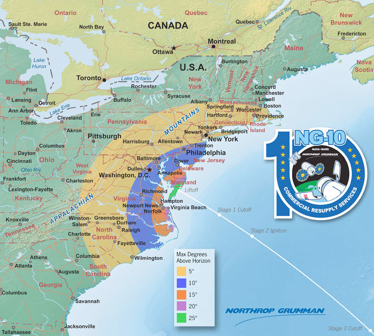
Maximum Elevation Map
This map shows the maximum elevation (degrees above the horizon) that Antares will reach during its first stage burn. The maximum elevation depends on your location; the further away you are from the launch site, the closer to the horizon the rocket will be. As a reference, when you look at your fist with your arm fully outstretched, it spans approximately 10 degrees. Thus if you are in Washington, DC the highest point Antares will reach is approximately 11 degrees above the horizon, or just slightly more than a fist's width. The contours shown stop below 5 degrees. It is unlikely that you'll be able to view the rocket when it is below 5 degrees due to buildings, vegetation, and other terrain features.

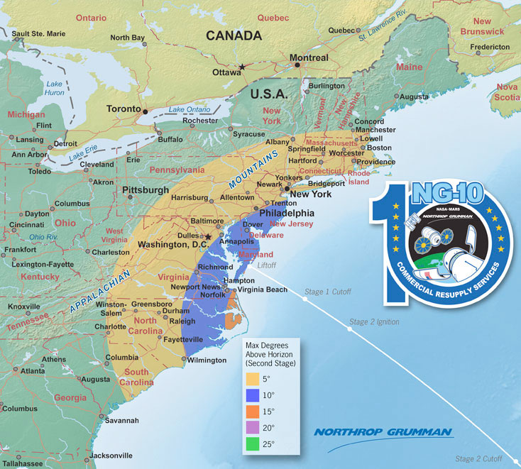
Second Stage Elevation Map
During second stage ignition, the rocket will still be fairly high up over the horizon as viewed from most locations. In addition, the solid motor on the second stage is usually brighter than the liquid fuel engines of the first stage. Even if you don't see the first stage, it is possible you may be able to spot the second stage! You should also remember that there is a 53 second gap between the first and second stages; during this time the rocket will not be visible. To facilitate you spotting the second stage, we have created a third map that shows the vehicles elevation (angle) over the horizon when the second stage lights up.


 posted 11-15-2018 07:20 AM