Space Newsspace history and artifacts articlesMessagesspace history discussion forumsSightingsworldwide astronaut appearancesResourcesselected space history documents
advertisements
NASA recreates iconic Apollo 8 'Earthrise' 45 years later using orbiter data (video)
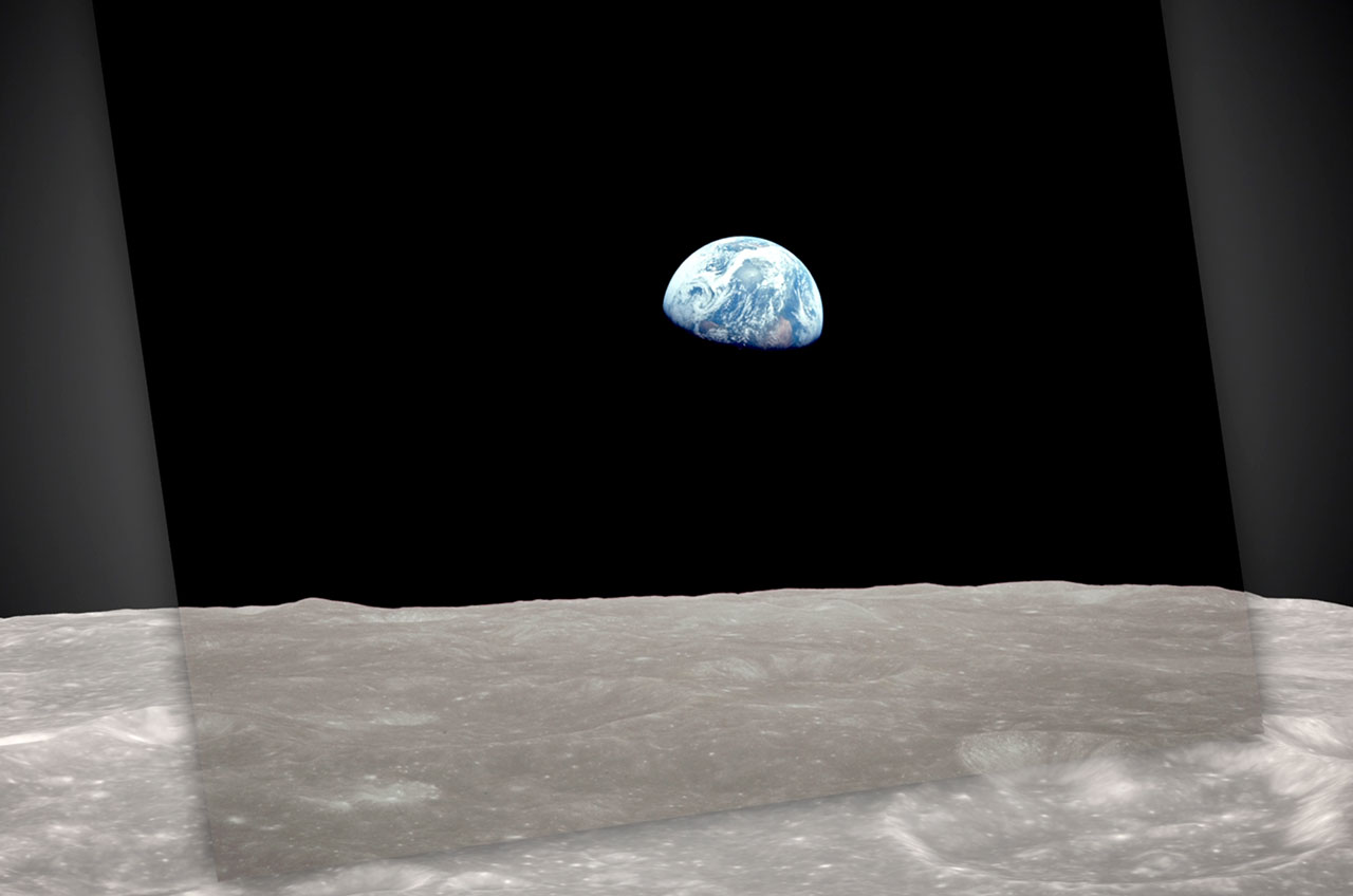
"Earthrise," as photographed by the Apollo 8 crew, laid over the recreation using Lunar Reconnaissance Orbiter data.(NASA)
December 20, 2013
– It is one of the most famous photos ever taken — the Earth rising over the moon's horizon as seen firsthand by the 1968 Apollo 8 crew. And yet, more than four decades later, details about how the photo was captured are still being uncovered.
Four days shy of the photo's 45th anniversary, NASA on Friday (Dec. 20) released a new simulation of the events that led to the creation of the image known as "Earthrise." The new video was created using topographic data from the space agency's Lunar Reconnaissance Orbiter (LRO), which has been circling the moon since 2009.
"This new simulation allows anyone to virtually ride with the astronauts and experience the awe they felt at the vista in front of them," NASA said in a release teasing the video.
It was Christmas Eve 1968, and the first lunar voyagers in all of history — Apollo 8 astronauts Frank Borman, James Lovell and William Anders — were emerging from behind the moon for the fourth time. It was then that Anders first spotted it, the Earth, peeking over the horizon.
"Oh my God! Look at that picture over there!" exclaimed Anders. "There's the Earth comin' up. Wow, is that pretty!"
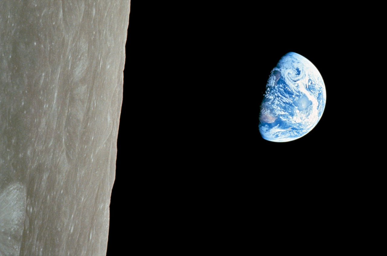
Apollo 8's "Earthrise," oriented as its photographer William "Bill" Anders saw it out his window on Christmas Eve 1968.(NASA)
What followed was an impromptu photo opportunity, first in black and white (building on the first "Earthrise" captured by NASA's Lunar Orbiter probe two years earlier) and then after quickly locating the proper film cartridge, in stunning full color.
"In lunar orbit, it occurred to me that, here we are, all the way up there at the moon, and we're studying this thing, and it's really the Earth as seen from the moon that's the most interesting aspect of this flight," Anders told author Andrew Chaikin for the 2009 book "Voices from the Moon" (Viking Studio).
Anders' color photo of the gibbous Earth hanging over the lunar surface was declared one of the "great images of the 20th century" and among "100 photographs that changed the world" as selected by the editors of TIME and LIFE magazines. Five months after the Apollo 8 crew returned to Earth, the U.S. Postal Service issued a postage stamp depicting Anders' "Earthrise."
But as well known as the photograph became, the details regarding its creation were limited for four decades to the astronauts' anecdotes. Then Ernie Wright, the project lead with the Scientific Visualization Studio at NASA's Goddard Space Flight Center in Maryland began reassembling the Apollo 8 crew's experience using data returned by LRO.
For Earth Day in 2012, Wright debuted his first take on the "Earthrise" visualization. The flight time was compressed and the simulated Earth did not exactly duplicate what the Apollo 8 astronauts saw.
Friday's video release addressed those issues and more.
"The Earthrise visualization that we released for Earth Day last year really only scratched the surface," Wright said in a NASA interview. "The new visualization tells us not only what time the photos were taken, but also exactly which way the [Apollo 8] spacecraft was pointing and therefore which window each photo was taken from."
"This [is] also the first time we've released a video that's synchronized with the audio recording of the astronauts," he added.
Wright credits both the precise modern data from LRO and archival photos from the 1968 mission for making the new simulation possible.
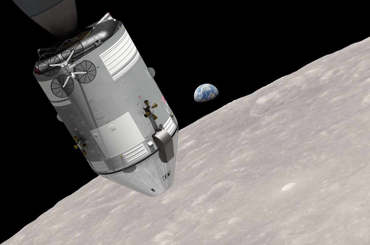
"The key to the new work is a set of vertical stereo photos taken by Apollo 8," Wright said. "A camera was mounted in the rendezvous window that pointed straight down onto the lunar surface [and] it took a picture every 20 seconds. When the spacecraft rotated, so did the images."
"By registering each photo to a model of the terrain from LRO data, we can nail down the timing of the spacecraft's rotation," he said.
As NASA's new simulation reveals, the Apollo 8 spacecraft was nose down and rolling when "Earthrise" was captured.(NASA)
To make the new simulation as faithful as possible, Wright also used the Apollo 8 flight plan, the onboard recording of the astronauts voices, data on the optical properties and mounting of the Hasselblad cameras, and the dimensions and angles of the command module windows.
A Dec. 24, 1968 map of the Earth from the Environmental Science Services Administration 7 satellite helped Wright recreate the planet's cloud patterns to match the images taken from the moon that day.
For Chaikin, who narrates the new simulation and who has studied and written extensively about the Apollo missions, the details revealed by the video are amazing.
"It never occurred to me that the spacecraft was nose-down when the Earthrise happened, or that it was actually still rotating as part of Borman's roll maneuver," Chaikin told collectSPACE. "But that explains why Anders was the first one to see it — the timing was just perfect for the Earth to appear in his right-hand window just as it was first peeking above the moon's horizon."
"It just proves what I have long realized," Chaikin added, "there's always more to discover about Apollo!"